Cyrsiau Ras – Race Courses
Ras Copaon 1000m Cymru – Welsh 1000m Peaks Race
Navigation
The Long and Short Course of the Welsh 1000m Peaks Race offer excellent mountain race experience, over rough and rocky ground, as well as more runnable grassy slopes and pitched stone paths, especially on Yr Wyddfa. The rugged and technical terrain of Eryri sets the race apart from many other ‘Classic A’ fell races in the UK. Hence the race demands significant experience, in similar terrain.
Upholding the ethos of fell running/racing and the Welsh Fell Runners Association (WFRA), the Welsh 1000m Peaks Race does not offer a marked course and there is no fixed route dictated between required summit/safety Checkpoints. In some sections of the race, competitors can choose their own route, within the bounds of public/race access, safety and environmental consideration. In other sections, the most obvious route is very defined and most/all competitors will take the same line.
The race defines certain areas as Out of Bounds (check Race Maps at Registration) and requires competitors to visit certain summit or safety Checkpoints (see below).
Competitors draw on their significant mountain experience and navigational skills to determine their most efficient route; reading the landscape around them and/or using a map when needed (and sometimes a compass if the visibility is very poor). A GPS device used for navigational purposes is not permitted at any WFRA registered race.
Read more about WFRA GPS Policy »
Checkpoints
On both the Long and Short Course, there are certain ‘Checkpoint’ locations that must be visited in order to generate your race result, and to help monitor competitor welfare and safety. At Race Registration, competitors will be given a GPS Tracker to place in their race vest/bum bag and this will record locations/timings throughout the race (see Kit & Safety).
Checkpoints will be identified by an Orange/White flag and/or a volunteer Race Marshal. Where volunteer Race Marshals are positioned on the course will be dictated by weather, dynamic risk assessment and availability of Race Marshals on race day itself. It is YOUR RESPONSIBILITY to locate each Checkpoint and ensure you have touched the Orange/White flag and/or presented yourself to the Race Marshal in location. There are no ‘dibber boxes’ to punch, though – but you must touch the Checkpoint to ensure you are near enough to the location for your time result to be recorded.
Race Maps
Competitors can opt to purchase an excellent Race Map, produced by Harvey Maps, via online entry or at Race Registration. Since these Race Maps were originally printed, some Checkpoint locations and Out of Bounds areas have changed. It is YOUR responsibility to mark up your maps with the current race information/Checkpoint locations, as per this website and copies of Race Maps displayed at Race Registration. You may also use your own maps, but please mark them accordingly to assist with timings and navigation.

‘BLANK’ HARVEY MAPS RACE MAP – 1:40,000 SCALE (you will need to mark it up!)

2025 ‘EXAMPLE’ RACE MAP AT REGISTRATION (some info will change for 2026)

ORANGE/WHITE CHECKPOINT FLAG
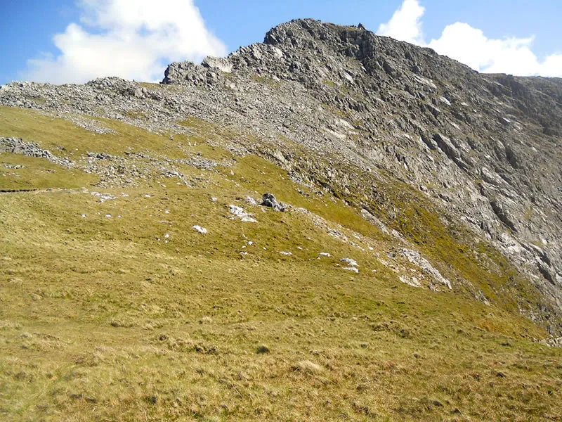
Y Gribin Ridge – Grade 1 Scramble
Both the Long and Short Course ascend Y Gribin – a rocky spur leading to Glyder Fawr, with some short sections of loose scree, rocky ground and Grade 1 (easiest) ‘scrambling’ near the top of Y Gribin. Competitors will require hands for support and use simple climbing moves and sensible route choices.
The ground is steep and complex in places, but competitors can keep away from the most exposed sections of ridge, by dropping down to the right/west side. Race Marshals will be visible at the start of the final, steep section of Y Gribin.
Long Course – Five 1000m Peaks – 32km / 20 miles - 2870m ascent
Abergwyngregyn - Carnedd Llewelyn – Carnedd Dafydd – Glyder Fawr – Garnedd Ugain – Yr Wyddfa
CHECKPOINTS AND RACE MARSHAL POINTS
Please amend your Race Map with these updated Checkpoint locations/timings
| Checkpoint | Runner Action | Grid Ref | Notes |
|---|---|---|---|
| START - LONG | Cross Start Line | SH 654 728 | |
| CP1 - ARYG | Touch Orange/White Flag | SH 680 673 | OPTIONAL Race Marshal |
| CP2 - LLEWELYN | Touch Orange/White Flag | SH 683 643 | OPTIONAL Race Marshal |
| CP3 - DAFYDD | Touch Orange/White Flag | SH 663 630 | OPTIONAL Race Marshal |
| DERELICT WALL | Avoid Out of Bounds Area | SH 675 630 | OPTIONAL Race Marshal |
| LOW WALL | Avoid Out of Bounds Area | SH 674 615 | OPTIONAL Race Marshal |
| CP4 - STILE | Touch Orange/White Flag | SH 674 611 | OPTIONAL Race Marshal |
| MRT ROAD | Caution on A5 Road | SH 673 607 | OPTIONAL Race Marshal |
| CP5 - GLAN DENA | Touch Orange/White Flag | SH 668 605 | 1200 CUT OFF + Water/Sweets |
| START - SHORT | Cross Start Line | SH 651 601 | |
| GRIBIN | Caution - Rocky Ground | SH 650 585 | OPTIONAL Race Marshal |
| CP6 - GLYDER FAWR | Touch Orange/White Flag | SH 642 579 | OPTIONAL Race Marshal |
| CP7 - PEN Y PASS | Touch Orange/White Flag | SH 647 556 | 1400 CUT OFF + Water/Sweets |
| CP8 - UGAIN | Touch Orange/White Flag | SH 610 551 | OPTIONAL Race Marshal |
| FINISH - WYDDFA | Touch Orange/White Flag | SH 609 543 | YES Race Marshals |
CUT OFFS – 1200 AND 1400
To maintain the progress and safety of competitors and Race Marshals, there will be two Cut Off times at Glan Dena Water Point at 1200 and Pen y Pass at 1400; these Cut Offs will be strictly adhered to. Any competitors arriving after Cut Off times will be retired from their race and required to hand in their Race Number/Tracker (if not returning to Llanberis Base). Race transport may be available from Ogwen – Pen y Pass (please do not rely on this!) and Public Buses depart Pen y Pass for Llanberis every 15 minutes (15 min journey – hence requirement for cash/card in Minimum Race Kit). Race Marshals will be able to advise further and can offer assistance if able to.
These Cut Offs are calibrated in line with previous race timings and results; providing appropriate time to cover the ground efficiently. Cut Off times may be amended prior to a race based on incoming weather hazards (competitors will be notified in advance, as far as practical) or in the event of an Adverse Weather route being deployed - which may be announced in advance or on race day itself.
Short Course – Three 1000m Peaks – 13 km / 8 miles - 1550m ascent
Ogwen Valley – Glyder Fawr – Garnedd Ugain – Yr Wyddfa
Checkpoints and Race Marshal Points
Please amend your Race Map with these updated Checkpoint locations/timings
| Checkpoint | Runner Action | Grid Ref | Notes |
|---|---|---|---|
| START - SHORT | Cross Start Line | SH 651 601 | |
| GRIBIN | Caution - Rocky Ground | SH 650 585 | OPTIONAL Race Marshal |
| CP6 - GLYDER FAWR | Touch Orange/White Flag | SH 642 579 | OPTIONAL Race Marshal |
| CP7 - PEN Y PASS | Touch Orange/White Flag | SH 647 556 | 1400 CUT OFF + Water/Sweets |
| CP8 - UGAIN | Touch Orange/White Flag | SH 610 551 | OPTIONAL Race Marshal |
| FINISH - WYDDFA | Touch Orange/White Flag | SH 609 543 | YES Race Marshals |
PEN Y PASS CUT OFF – 1400
To maintain the progress and safety of competitors and Race Marshals, there will be a Cut Off at Pen y Pass at 1400; this will be strictly adhered to. Any competitor arriving at Pen y Pass after 1400 will be retired from their race, and required to hand in their Race Number/Tracker (if not returning to Llanberis Base). Public Buses depart Pen y Pass for Llanberis every 15 minutes (15 min journey – hence requirement for cash/card in Minimum Race Kit) and Race Marshals will be able to advise further. This Cut Off time may be amended prior to a race based on incoming weather hazards (competitors will be notified in advance, as far as practical) or in the event of an Adverse Weather route being deployed - which may be announced in advance or on race day itself.
Yr Wyddfa Summit
The race finishes on the summit of Yr Wyddfa. You are advised to return to Llanberis Base to hand in your Tracker – or hand it in to a Race Marshal at the summit if you are descending to another location. Please note that Yr Wyddfa Visitor Centre Café is not always open, so can’t be relied upon as a resource. Competitors must have sufficient energy/water and the ‘Minimum Race Kit’ extra clothing available at the summit, and for the descent from Yr Wyddfa. There should be no reliance on Race Marshals being able to provide food/drink/shelter by default.
Provision is made for unforeseen circumstances only, and this is limited. Competitors are not able to purchase ‘single descent’ tickets from Snowdon Mountain Railway; please plan to descend on foot to Llanberis Base via the Llanberis Path (NOT the Snowdon Ranger Path, by mistake – if you cross the railway line when descending, you are heading down the wrong path!)
Adverse Weather – Long and Short Course Options
At the Race Organiser’s discretion, an Adverse Weather Course may be implemented for the Long and/or Short Course and this decision will be shared (at the very latest) at Race Registration. In this instance, the Race Organiser will aim to publish any Adverse Weather Course routes prior to the race (if possible) and at Race Registration, so routes/information can be marked on Race Maps. If weather is hazardous enough to abort exposed summit routes, then very few options are workable for this particular race. Options include ALL competitors following the Short Course or a lower alternative to the Short Course and ascent to Yr Wyddfa, if possible.
Decisions regarding Adverse Weather Courses seek to prioritise the safety and well-being of all Race Marshals and competitors, especially over high ground for long periods of time. Adverse ‘summer’ weather conditions can include extreme heat, very high winds and threat of lightning. Cancellation of a race is the last possible resort, but may be required in these contexts. Competitors will be informed at the most appropriate time to allow for the most up to date risk assessment to take place.
Awareness of Hazards and Risk


